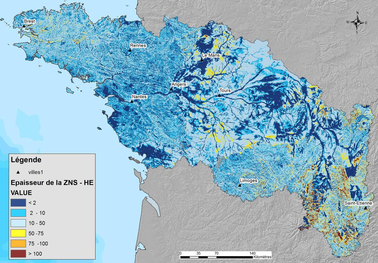
Final grid of the thickness of the unsaturated zone during high water periods at 250m intervals (Loire-Brittany basin, 2019).
© BRGM
The need
Conducted in partnership with the Loire-Brittany Water Agency, the project aimed to answer the question posed by the Water Framework Directive concerning the definition of a "good quantitative status" and the principle of balanced management, which requires that abstractions do not exceed the renewal capacity of the available water resource. Consequently, the volume of water withdrawn must be adapted to take into account the water needed to supply the surface aquatic ecosystems and wetlands directly dependent on these resources.
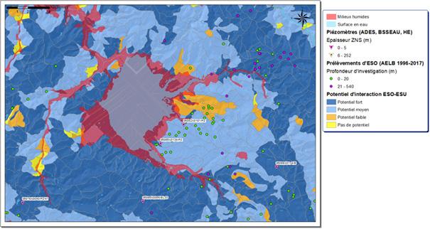
Map of the potential for interaction between groundwater and surface water (wetland area of the Grand Lieu Lake, Loire-Atlantique, 2019).
© BRGM
The results
The study led to the development of methods that could identify the sensitivity of watercourses and the variation in the size of wetland areas due to groundwater abstraction across the whole Loire-Brittany basin.
To begin with, the minimum and maximum levels of the unsaturated zones were calculated according to the hydrogeological context using geostatistical methods. Based on these interpolated data, the second step involved quantifying any potential link between groundwater and surface water. Targeted data and indicators were used to confirm whether any link existed or not, using a classification method. The final part of the study involved identifying the watercourses that were sensitive to groundwater abstraction, i.e. the sectors in which the flow could become insufficient to ensure the continuity of the ecological systems or meet the needs of the various uses. The final map shows both the sensitive zones around the watercourses, defined using hydrodynamic parameters, and the differences in flow direction between high and low water periods.
Using the results
The two maps produced during this study provide strategic orientation and planning tools for future water management policies across the entire basin. They can also be used for crisis-management decision-making (drought and flooding) or to update the demarcation of zones in the Master Plan for Water Development and Management (SDAGE) as well as the demarcation of Water Allocation Areas (ZRE). However, given the data used and their scope of validity, the maps must be considered as indicative for use at the defined scale and cannot replace more local studies.
The partners
- Loire-Brittany Water Agency


